Sheinbaum Responds to Trump: “Mexico Is Not and Will Not Be a Colony”
This article by Fernanda Monroy originally appeared in the September 7, 2026 edition of Contralínea, Mexico’s leading investigative journalism magazine.
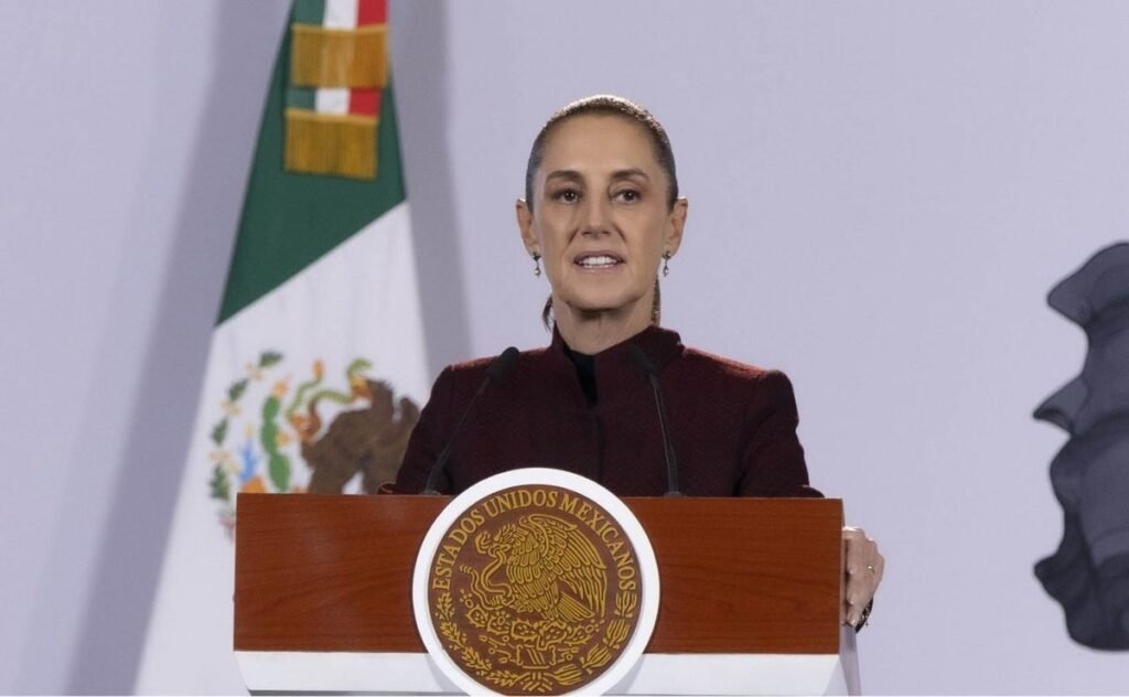
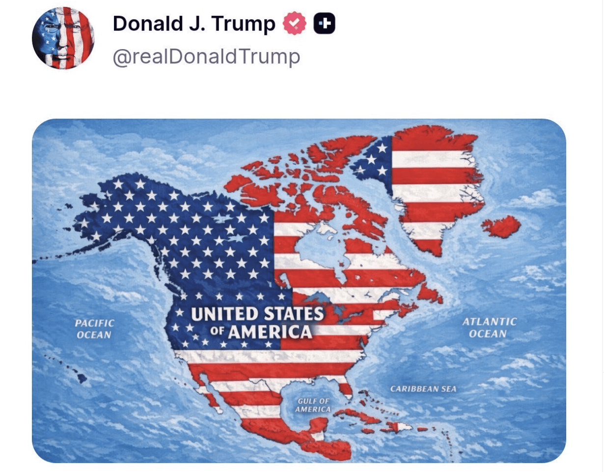
Mexico “is not and will not be a colony or protectorate of any foreign country,” declared President Claudia Sheinbaum Pardo, after U.S. President Donald Trump circulated on social media a map in which Mexico, Canada, Greenland, and other territories appear covered with elements of the United States flag.
Amid the month of the homeland, the president responded to the post through her X account and reaffirmed national sovereignty: “In the month of the homeland, we reaffirm that Mexico is not and will not be a colony or protectorate of any foreign country.”
We are proudly a free, independent, and sovereign country.
President Claudia Sheinbaum
Post by @Claudiashein on X
President Trump’s post adds to a series of messages and decisions related to the geographic representation of territories and bodies of water in North America.
Just a day earlier, Trump had circulated on his Truth Social network an image of the state of New Mexico in which the word “Mexico” appeared crossed out and replaced with “America.” In addition, the president has also publicly proposed calling the state “New America,” although the U.S. federal government does not have the authority to unilaterally change a state’s official name.
The proposal drew rejection from New Mexico authorities. Governor Michelle Lujan Grisham maintained that the state’s name “is not up for debate” and recalled that its name has existed since before the creation of the United States.
Likewise, President Claudia Sheinbaum’s response comes just days after the General Assembly of the United Nations (UN) approved a resolution to promote cartographic representations that more accurately reflect the size of the continents.
The document, promoted by Togo and other African countries, received 164 votes in favor, one against—that of the United States—and six abstentions. The resolution promotes the use of projections such as Equal Earth, which represent the surface of landmasses more proportionally and question the widespread use of the Mercator projection.
The UN’s proposal calls for governments, international organizations, educational institutions, and other actors to use representations that make it possible to more faithfully appreciate the relative dimensions of territories.
The Mercator projection, created in the 16th century to facilitate navigation, distorts the size of surfaces as latitude increases. As a result, northern territories appear visually much larger than they actually are. Greenland, for example, can appear comparable in size to Africa on this type of map, even though the African continent has a surface area roughly 14 times larger.
During the discussion at the United Nations, Togo’s Minister of Foreign Affairs, Robert Dussey, argued that maps are not merely technical tools, but representations that influence the way societies understand the world. “Maps shape our understanding of the world.”
The debate over cartographic representation thus took on a political and cultural dimension: while the initiative promoted by African countries seeks to reduce a historical distortion in the way territorial dimensions are represented, the image circulated by Trump places territories belonging to other countries under U.S. symbols.
The post about Mexico is also part of a policy of changing geographic names promoted by Trump since the start of his second term.
In January 2025, the president signed an executive order for the U.S. government to use the name “Gulf of America” to refer to the Gulf of Mexico. The measure has effects within the U.S. government and does not by itself change the body of water’s international designation.
More recently, on August 27, 2026, Trump signed another executive order for the U.S. government to use “Lake America” instead of Lake Ontario in its official references. The document instructed the Department of the Interior and the U.S. Board on Geographic Names to carry out the corresponding actions within the federal geographic names system.
Added to this series of actions is now the proposal to rename New Mexico as “New America,” as well as the image circulated in which Mexico and Canada appear under the U.S. flag.
The name of New Mexico, moreover, has a history that predates the creation of the United States and of independent Mexico. The designation began to be used during the Spanish colonial period to identify territories located north of New Spain and remained after Mexican independence and the territory’s incorporation into the United States.
President Sheinbaum’s response comes as her government maintains, as one of its main foreign-policy matters, the relationship with the United States, in which it has emphasized binational cooperation without accepting a relationship of subordination.
-
Perception of Insecurity in Mexico Reached the Lowest Level on Record
Since 2018, when it stood at 74.9%, the figure has fallen almost 17 points, though women still feel less safe than men.
-
Morena Leader Accuses Chihuahua Governor of Slandering Her: She Represents “Corruption, Privilege, and Disloyalty”
She said Mexico deserves to know who authorized CIA agents’ role in a Chihuahua operation, after Campos linked her to drug trafficking in an interview.
-
Maru Campos Assured Me Jáuregui Was Corrupt and a Casino Owner, Sheinbaum Says
Asked who let foreign agents into the Chihuahua operation, Campos told her “it wasn’t me, it was the prosecutor,” in a tense meeting in Ciudad Juárez.